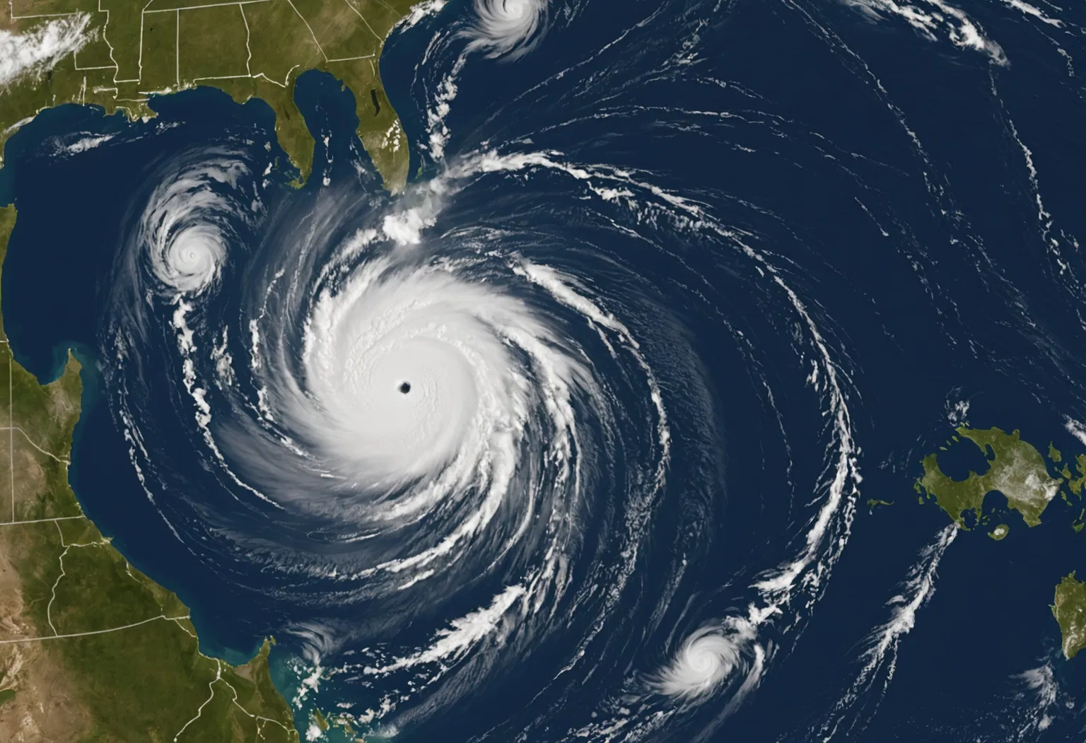
Hurricane Isaias became the first hurricane of the 2026 Atlantic season in early October — and it did so in dramatic fashion, rapidly intensifying into a powerful Category 3 storm over the unusually warm waters of the Gulf of Mexico. With maximum sustained winds reaching about 120 mph and landfall expected along the northern Gulf Coast between Gulf Shores, Alabama, and the Florida Panhandle, Isaias quickly became the season's most closely watched storm. But to understand what made Isaias so dangerous — and why millions of people were glued to hurricane trackers and forecast cones — it helps to start with the basics: how hurricanes form, how meteorologists track them, and what a label like "Category 3" actually means.
This guide breaks down the science behind Hurricane Isaias, from the warm ocean water that fueled its explosive growth to the satellites and hurricane-hunter aircraft that let forecasters predict its every move.
How a Hurricane Is Born: The Four Ingredients That Powered Isaias
Hurricanes are, at their core, giant heat engines that run on warm, moist ocean air. According to NASA, a tropical cyclone "uses warm, moist air as fuel," which is why these storms only form over warm ocean waters near the tropics and never over land or cold seas.
Meteorologists point to four main ingredients a storm needs to grow into a hurricane:
- Warm ocean water — at least 80°F (about 26.5°C) down to a depth of roughly 150 feet. This heat is the storm's energy source.
- Moist, unstable air — rising warm, humid air cools as it climbs, condenses into towering clouds and thunderstorms, and releases heat that further warms the surrounding air, driving even more rising motion.
- Light winds aloft (low wind shear) — strong winds blowing in different directions at different heights can tear a developing storm apart. Calmer upper-level winds let the storm stay organized and upright.
- A trigger to start the spin — converging winds near the surface, combined with Earth's rotation (the Coriolis effect), give the storm its signature counterclockwise swirl.
Isaias had all four. The storm spun up over a Gulf of Mexico that was running unusually warm for October — a fact forecasters and climate scientists repeatedly cited as a key reason for the storm's rapid strengthening.
From Tropical Wave to Category 3: The Life Cycle of a Storm
Most hurricanes do not appear out of nowhere. According to NOAA's National Ocean Service, they often begin as a "tropical wave" — a low-pressure area that drifts through the moisture-rich tropics, triggering clusters of showers and thunderstorms. From there, a storm climbs a well-defined ladder:
- Tropical disturbance: A cluster of thunderstorms with a weak or disorganized circulation.
- Tropical depression: The system develops a closed circulation with sustained winds below 39 mph. It gets a number.
- Tropical storm: Winds reach 39 to 73 mph and the storm receives a name — in this case, Isaias.
- Hurricane: Sustained winds hit 74 mph or higher, and the storm develops a defined eye surrounded by an eyewall of intense thunderstorms.
Isaias moved through these stages quickly. It was still a tropical storm on Oct. 7, when the National Hurricane Center (NHC) began issuing detailed advisories from its Miami headquarters. Within about a day it had strengthened into a hurricane and then — in a process forecasters call "rapid intensification" — exploded into a major Category 3 storm.
Timeline: How Hurricane Isaias Exploded Over Record-Warm Gulf Waters
Isaias's development was unusually fast even by Gulf of Mexico standards. Here is how the storm unfolded:
- Early October 2026: A tropical disturbance spins up over the southwestern Gulf of Mexico, where water temperatures are running well above the 80°F threshold hurricanes need.
- Tuesday, Oct. 6–7: The system organizes into Tropical Storm Isaias. NHC Director Michael Brennan briefs the public on the storm's potential.
- Wednesday–Thursday, Oct. 7–8: Isaias intensifies steadily. NOAA's GOES East (GOES-19) satellite captures infrared imagery of the storm churning in the Gulf, and hurricane-hunter aircraft begin flying into the core to measure wind speeds and pressure directly.
- Thursday–Friday, Oct. 8–9: Isaias undergoes rapid intensification — its winds climbing at least 35 mph in 24 hours, and by some measurements about 40 mph — becoming the season's first hurricane and then a major Category 3 storm with sustained winds near 120 mph.
- Friday night into Saturday, Oct. 9–10: Landfall is forecast along the northern Gulf Coast, with the most likely zone between Gulf Shores, Alabama, and the far western Florida Panhandle.
The storm's rapid rise also carried historical weight: NOAA noted that Isaias's formation marked the latest "first hurricane" of an Atlantic season on record — a reminder of how unusual this late-season system was.
What Category 3 Means — and Why Isaias's Rapid Intensification Matters
When forecasters call Isaias a "Category 3," they are using the Saffir-Simpson Hurricane Wind Scale, which ranks hurricanes from 1 to 5 based on maximum sustained winds. Category 3 and above are considered "major" hurricanes.
- Category 1: 74–95 mph — dangerous winds, some damage.
- Category 2: 96–110 mph — extremely dangerous winds, extensive damage.
- Category 3: 111–129 mph — devastating damage will occur.
- Category 4: 130–156 mph — catastrophic damage will occur.
- Category 5: 157 mph or higher — catastrophic damage; most of the area uninhabitable for weeks or months.
At 120 mph, Isaias sat solidly in the Category 3 range. But the more important number for forecasters was the speed of the change. "Rapid intensification" is defined as a jump of at least 35 mph in sustained winds within 24 hours — and Isaias cleared that bar. The Washington Post reported that damaging wind gusts up to about 100 mph were expected in the landfall zone, with tropical-storm-force winds reaching far inland.
Why does rapid intensification matter so much? Because it compresses the window for evacuations and preparations. A storm that jumps from tropical storm to major hurricane in a day leaves coastal communities far less time to respond. Scientists have also linked this behavior to warming oceans: hotter water supplies more of the heat energy that drives explosive strengthening, a connection highlighted by Yale Climate Connections, which reported that Isaias was intensifying over record-warm Gulf waters.
How Forecasters Track a Hurricane: Satellites, Hurricane Hunters and the Forecast Cone
Tracking a hurricane like Isaias is a high-tech, around-the-clock effort that combines three main tools.
Weather satellites provide the big picture. Geostationary satellites such as NOAA's GOES East capture visible and infrared images of storms — often every 15 to 30 minutes — letting forecasters watch a hurricane's structure, size and movement in near real time. Infrared imagery is especially useful at night, showing the temperature of cloud tops and revealing how vigorously a storm is churning.
Hurricane-hunter aircraft get the ground truth. These specially equipped planes fly directly into the eye of the storm, dropping instruments that measure wind speed, pressure, temperature and humidity. The data they collect is often the first confirmation that a storm is strengthening — and it was hurricane-hunter data that revealed Isaias's winds had climbed to 120 mph.
Computer models and the forecast cone turn all of that data into a prediction. The National Hurricane Center runs observations through many different models and publishes a "cone of uncertainty" showing the probable path of the storm's center. The solid portion of the cone represents uncertainty over days one through three, while the stippled area covers days four and five. "Spaghetti models" — the individual tracks from many different models — show how much agreement (or disagreement) exists among forecasts. The NHC updates its advisories and cone every six hours, at roughly 5 a.m., 11 a.m., 5 p.m. and 11 p.m. Eastern time.
Where Things Stand Now: Latest on Hurricane Isaias
As of the latest advisories, Hurricane Isaias was a Category 3 storm with maximum sustained winds around 120 mph, positioned in the Gulf of Mexico and moving toward the northern Gulf Coast. Hurricane and storm-surge warnings were in effect across a stretch of coast from Louisiana to Florida, and evacuation orders were expanding. Alabama Gov. Kay Ivey ordered non-residents to immediately evacuate Gulf Shores, Orange Beach and Dauphin Island, while a storm-surge warning covered the immediate coastal areas of Mobile, Baldwin, Escambia, Santa Rosa and Okaloosa counties.
Forecasters expected the storm to approach the coast late Friday and make landfall between roughly 9 p.m. and midnight, most likely between Gulf Shores, Alabama, and the far western Florida Panhandle. Beyond the wind, officials warned that storm surge — the rise in sea water pushed ashore by the storm — posed the greatest threat to life, with dangerous flooding possible well away from the storm's center.
What Happens Next: The Road Ahead for the Gulf Coast
Once Isaias moves ashore, the immediate threat shifts from wind to water. Hurricanes typically weaken quickly after landfall because they lose their warm-water fuel, but they can still unleash torrential rain, flash flooding and even tornadoes hundreds of miles inland. Forecasters expected Isaias to continue north-northeast after landfall, spreading heavy rain and gusty winds across the Southeast before gradually losing strength.
For residents, the days ahead mean paying close attention to official NHC updates and local evacuation orders rather than any single forecast line — because, as the NHC emphasizes, the cone shows only the probable path of the center, and dangerous conditions routinely occur far outside it.
Key Takeaways: What to Know About Hurricane Isaias
- Isaias was the first hurricane of the 2026 Atlantic season and the latest "first hurricane" on record.
- It rapidly intensified into a Category 3 major hurricane with sustained winds near 120 mph.
- Hurricanes need warm water (80°F+), moist air, low wind shear, and a trigger for rotation to form.
- The storm was fueled by record-warm Gulf of Mexico waters, a factor linked to climate change.
- Forecasters track hurricanes using satellites, hurricane-hunter aircraft, and computer-model forecast cones.
- Landfall was expected along the northern Gulf Coast — between Alabama and the Florida Panhandle — late Friday into Saturday.