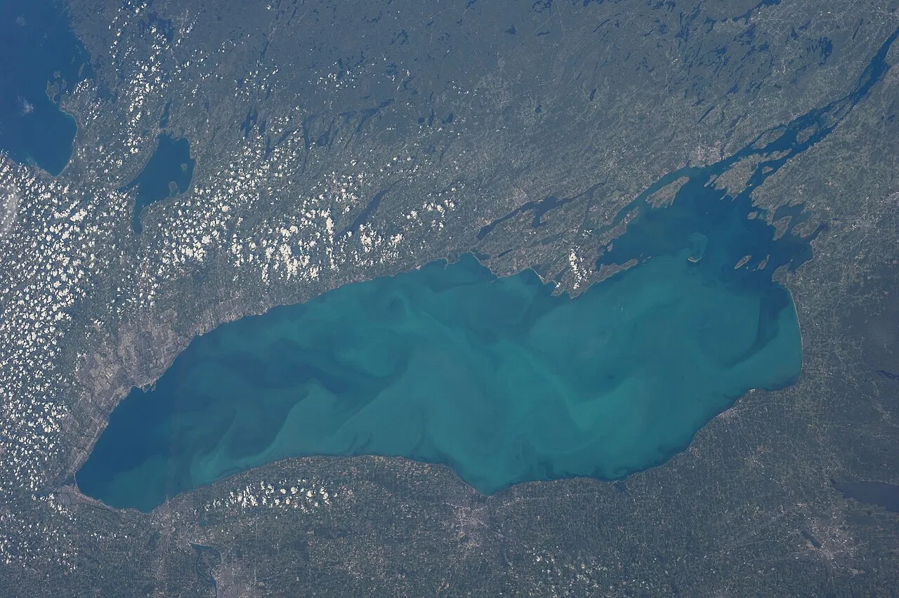
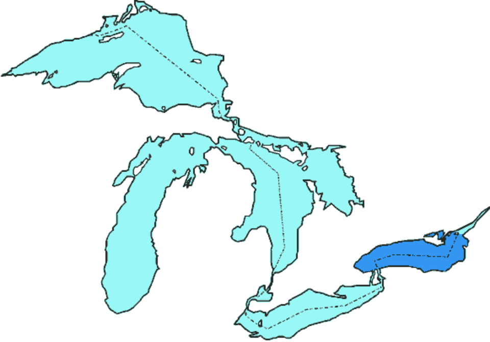
Lake Ontario is the easternmost of the five Great Lakes of North America, and while it is the smallest of the group by surface area, it is deeper than its upstream neighbor Lake Erie and holds far more water. The lake is bordered by the Canadian province of Ontario to the north, west, and southwest and by the U.S. state of New York to the south and east, with the Canada–United States border running through its center. As the final lake in the Great Lakes chain, it funnels the entire system's outflow into the St. Lawrence River and onward to the Atlantic Ocean. It has also drawn fresh global attention under a new name: following a 2026 executive order, it is now listed as "Lake America" in official United States government documents. Here is a complete explainer on how the lake formed, how deep it runs, what lives in it, and why it matters.
What Is Lake Ontario? Size, Depth and Key Facts
Lake Ontario spans 7,340 square miles (about 19,000 square kilometers), making it the smallest Great Lake by surface area, yet it still ranks as the 13th-largest lake in the world. It stretches 193 miles (311 km) at its longest and 53 miles (85 km) at its widest. The average depth is 283 feet (86 m), and the deepest point plunges to 802 feet (244 m) in the Rochester Basin. Thanks to that depth, Lake Ontario's volume of roughly 393 cubic miles (1,640 cubic kilometers) exceeds Lake Erie's, even though Erie covers more area. The surface sits at an elevation of 243 feet (74 m) above sea level—the lowest of all five Great Lakes—and the shoreline, including islands, runs about 712 miles (1,146 km).
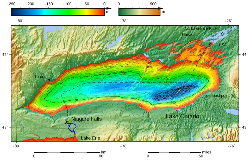
Water enters the lake primarily through the Niagara River, which carries the outflow of Lake Erie over Niagara Falls, and exits through the St. Lawrence River. The drainage basin covers about 24,720 square miles (64,000 square kilometers) across both Canada and the United States. On average, a drop of water stays in the lake for about six years, a figure scientists call retention time.
How Was Lake Ontario Formed? A Story Carved by Ice
Like the other Great Lakes, Lake Ontario owes its existence to the glaciers of the last ice age. The basin was carved out of soft, weak Silurian-age rock by the Wisconsin ice sheet, which followed a pre-glacial channel known as the Ontarian River that ran in roughly the same orientation as today's lake. As the ice advanced and retreated, it pushed material southward, leaving behind drumlins, kames, and moraines across both the modern land surface and the lake bottom, reorganizing the region's entire drainage system.
As the ice sheet melted northward, it temporarily dammed the St. Lawrence Valley outlet, raising the water to a higher level in a stage scientists call glacial Lake Iroquois. During that period, the lake drained through present-day Syracuse, New York, into the Mohawk and Hudson rivers. Once the ice receded from the St. Lawrence Valley, the outlet dropped below sea level and the lake briefly became a bay of the Atlantic Ocean, linked to what is now called the Champlain Sea. The land has been rebounding ever since the weight of roughly 6,500 feet (2,000 m) of ice was lifted, and it still rises about 12 inches (30 cm) per century near the St. Lawrence. Because the rebound is strongest where the ice melted last, the lakebed is slowly tilting southward—inundating the south shore and turning river valleys into bays.
Why Lake Ontario Almost Never Freezes Over
Despite harsh winters, Lake Ontario rarely freezes over completely because of its great depth. Typically, between 10% and 90% of the surface develops ice, concentrated along the shoreline and in shallow, sheltered bays. The lake has frozen over entirely only five times in recorded history: in 1830, 1874, 1893, 1912, and 1934. The lake also has a natural seiche—a slow, rocking standing wave—with a rhythm of about eleven minutes.
The lake's relatively warm water powers the region's famous lake-effect snow. When cold winter winds from the northwest sweep over the warmer water, they pick up moisture and dump it as snow on the southern and southeastern shoreline, an area known as the snowbelt. In some winters, communities between Oswego and Pulaski, New York, and the Tug Hill Plateau to the east receive twenty feet or more of snow. The same moderating effect protects orchards along the southwest shore, where apples, cherries, pears, plums, and peaches are grown, and where the Niagara Peninsula supports a major fruit-growing and wine-producing region.
What Lives in Lake Ontario? Fish, Birds and Wetlands
The Great Lakes watershed is a biodiversity hotspot, and Lake Ontario supports an array of birds, fish, reptiles, amphibians, and plants, many of them tied to shoreline dunes, lagoons, and wetlands. Wetlands are especially important as fish nurseries and resting places for migratory birds, but many have shrunk because natural water-level fluctuations have been reduced by regulation. Stabilized levels allow invasive cattails to crowd out native plants and can accelerate eutrophication, which feeds harmful algal growth.
Most forests around the lake are temperate deciduous woodlands dominated by maple, oak, beech, ash, and basswood. Widespread deforestation over the past two centuries removed more than 90% of forest cover in some areas, contributing to the extinction of native salmon and increasing sediment runoff into the lake. Because Lake Ontario is the most downstream Great Lake, it also collects pollution carried in from the other four lakes. A 2015 ecological study ranked it the most environmentally stressed of the five, citing agricultural fertilizer runoff, aging municipal sewage systems, industrial chemicals, and urban drainage from cities such as Toronto, Rochester, and Hamilton. By the 1960s and 1970s, summer algal blooms were killing large numbers of fish and leaving decomposing algae piled along the shore.
Why Lake Ontario Matters: Drinking Water, Shipping and the Economy
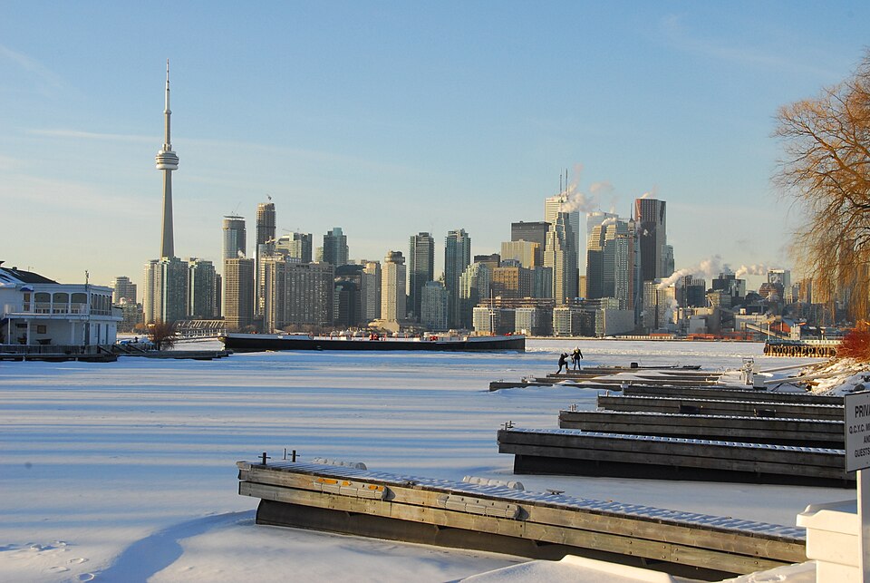
Close to 9 million people—more than a quarter of Canada's population—live within Lake Ontario's watershed, alongside more than 2 million people on the American side. The lake supplies drinking water, supports commercial ports such as the Port of Toronto and the Port of Hamilton, and anchors the Golden Horseshoe, the dense urban corridor around Toronto and Hamilton where Hamilton Harbour hosts major steel production.
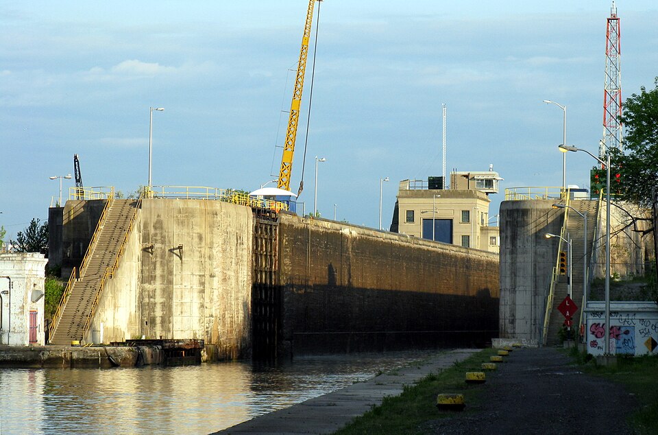
The lake is a vital link in the Great Lakes Waterway. The Welland Canal connects Lake Ontario to Lake Erie around Niagara Falls, while the St. Lawrence Seaway links the lake to the Atlantic Ocean, and the Trent-Severn, Rideau, and Oswego canals provide additional recreational and navigational routes. In September 2024, the United States designated the Lake Ontario National Marine Sanctuary, protecting 1,722 square miles (4,460 square kilometers) of U.S. waters rich with shipwrecks and of cultural and spiritual importance to the Haudenosaunee Confederacy. Although the Great Lakes once supported an industrial-scale fishery with record hauls in 1899, overfishing collapsed the industry, and today only recreational fishing remains.
From Lake Ontario to "Lake America": A Long History of Names
The name "Ontario" is generally traced to the Iroquoian word Kaniatarí:io, meaning "lake of shining waters" or "beautiful lake," though it is also linked to the Wyandot word Ontarí:io, meaning "great lake." It has been in use since at least 1639. During the French colonial era, explorers gave the lake other names—Lac de St. Louis, Lacus Ontarius, and Lac Frontenac—but Ontario ultimately stuck. The first European believed to have reached the lake was Étienne Brûlé in 1615.
In August 2026, amid an ongoing trade dispute with Canada, U.S. President Donald Trump signed an executive order renaming the lake "Lake America." The change is now reflected in official U.S. government materials—the Environmental Protection Agency lists the lake as "Lake America" in its physical-features tables and lakewide action plans—while "Lake Ontario" remains the widely used name in Canada and internationally. The move echoes earlier U.S. renamings of the Gulf of Mexico to the "Gulf of America" and of Denali back to Mount McKinley.
What Happens Next for Lake Ontario
Hydrologically and ecologically, the lake itself is unlikely to change course quickly. Scientists continue to monitor water levels, invasive species, and pollution under the binational Great Lakes Water Quality Agreement, with cleanup efforts such as the $150 million Randle Reef remediation in Hamilton Harbour ongoing. Post-glacial rebound will keep tilting the basin for centuries to come. The naming question, however, remains politically contentious: while U.S. federal agencies have adopted "Lake America," many maps, schools, and international bodies continue to use "Lake Ontario," and the dispute may take years to settle.
The Bottom Line: Key Points to Remember
- Lake Ontario is the smallest Great Lake by surface area (7,340 sq mi) but is deeper than Lake Erie, reaching a maximum depth of 802 feet.
- It was carved by the Wisconsin ice sheet during the last ice age and is still rising due to post-glacial rebound.
- Because of its depth, the lake has frozen over completely only five times on record.
- Nearly 9 million Canadians and more than 2 million Americans live in its watershed.
- In 2026, a U.S. executive order renamed it "Lake America" in official U.S. documents.