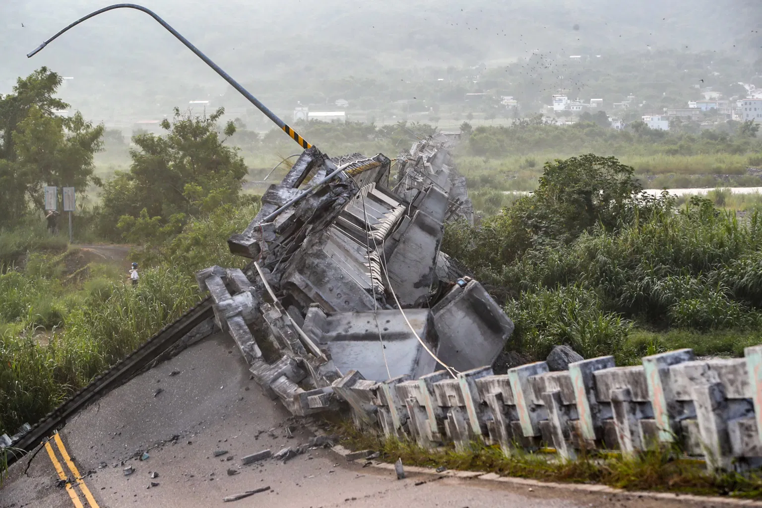
Every year, the Earth experiences approximately 500,000 detectable earthquakes — yet only about 100,000 can be felt, and just 100 or so cause significant damage. For the roughly 52 million people living in Colombia, earthquakes are not an abstract geological concept but a recurring reality shaped by the country's position atop one of the most volatile tectonic boundaries on the planet. Understanding what causes earthquakes, why Colombia is particularly vulnerable, and what you can do to stay safe is essential knowledge for anyone living in or traveling through seismically active regions.
The Tectonic Forces Shaping Colombia's Landscape
Colombia's seismic story begins deep beneath its surface, where the Nazca Plate — a massive slab of the Earth's oceanic crust — steadily pushes eastward and dives beneath the South American Plate at a rate of approximately 6 to 7 centimeters per year. This process, known as subduction, occurs along the Pacific coast and is the primary engine driving Colombia's earthquake activity. As these enormous tectonic plates grind against each other, friction causes them to lock together temporarily, building up immense strain over decades or even centuries. When that stress finally overcomes the friction, the rocks fracture and slip, releasing energy in the form of seismic waves that ripple through the Earth's crust.
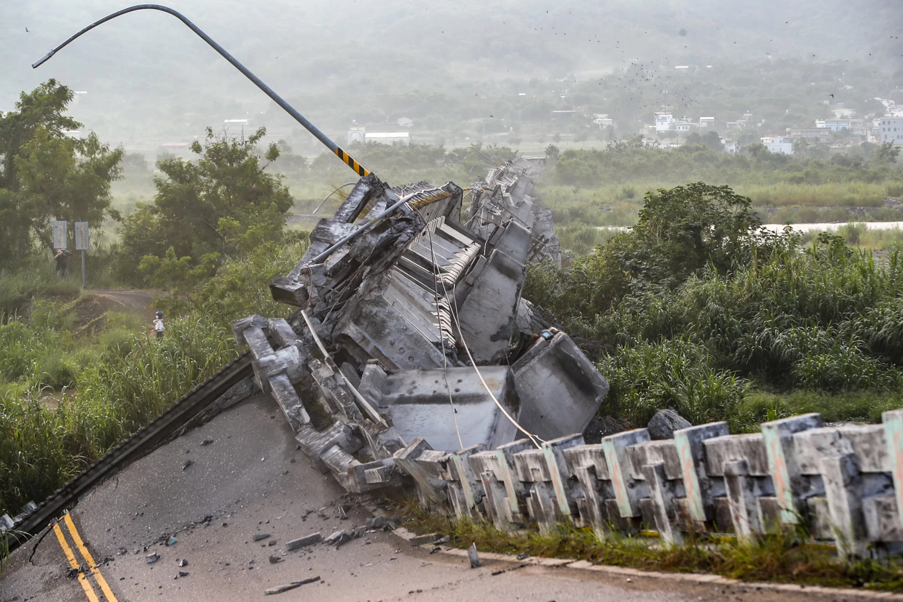
But subduction isn't the whole story. Colombia's interior is crisscrossed by a complex network of fault systems, including the Romeral Fault System, the Eastern Frontal Fault System, and the Santa Marta-Bucaramanga Fault. These faults accommodate the compression and shearing forces generated by the plate collision, creating multiple zones where earthquakes can — and regularly do — occur. The Bucaramanga Seismic Nest, located beneath the department of Santander, is one of the deepest and most concentrated clusters of intermediate-depth earthquakes on the planet, with tremors originating between 140 and 200 kilometers below the surface. Seismologists have recorded thousands of quakes in this single nest, which produces shaking nearly every day.
A Timeline of Colombia's Most Significant Earthquakes
Colombia's earthquake history is punctuated by devastating events that have shaped both its physical landscape and national consciousness. On January 25, 1999, a magnitude-6.2 earthquake struck the coffee-growing region near Armenia, in the department of Quindío. The quake, which originated at a shallow depth of approximately 17 kilometers, killed roughly 1,900 people, injured over 4,000, and destroyed or damaged nearly 50,000 buildings. The city of Armenia was particularly hard hit, with entire neighborhoods reduced to rubble. The economic toll exceeded $1.5 billion, making it one of the costliest natural disasters in Colombia's modern history.
Earlier events have also left deep scars. In 1983, a magnitude-5.5 earthquake struck the city of Popayán, killing about 300 people and destroying much of the historic colonial center. In 1979, a magnitude-7.7 earthquake off Colombia's Pacific coast generated a tsunami that killed over 500 people along the Nariño coastline. Historical records from 1875 describe a powerful earthquake that devastated the city of Cúcuta, near the Venezuelan border, destroying nearly every building and causing widespread casualties. More recently, in August 2023, a magnitude-6.1 earthquake with an epicenter near El Calvario in Meta department shook Bogotá and much of central Colombia, causing one fatality, structural damage, and widespread panic — a stark reminder that seismic risk remains ever-present.
How Scientists Measure and Monitor Earthquakes
When you hear that an earthquake was a "magnitude 6.2," that number comes from a measurement system that has evolved significantly over the past century. The original Richter scale, developed by Charles Richter in 1935, measured the amplitude of seismic waves recorded on a specific type of seismograph. Today, seismologists primarily use the moment magnitude scale (Mw), which provides a more accurate measurement for large earthquakes by calculating the total energy released based on the area of the fault that slipped, the average amount of slip, and the rigidity of the rocks involved.
The scale is logarithmic, which means each whole-number increase represents roughly 32 times more energy released. A magnitude-7.0 earthquake releases about 1,000 times more energy than a magnitude-5.0 quake. To put that in perspective, the 1999 Armenia earthquake at magnitude 6.2 released energy equivalent to nearly 200,000 tons of TNT. The Colombian Geological Service (Servicio Geológico Colombiano, or SGC) maintains a national seismic network of over 100 monitoring stations that continuously record ground motion across the country, providing real-time data that helps emergency responders assess damage and direct resources where they are needed most.
Beyond magnitude, seismologists also measure an earthquake's intensity using the Modified Mercalli Intensity (MMI) scale, which ranges from I (not felt) to XII (total destruction). Intensity varies by location and depends on factors such as distance from the epicenter, local geology, and building construction. Soft soils, like those found in parts of Bogotá built on an ancient lakebed, can amplify seismic shaking — a phenomenon known as site amplification — making the ground motion felt in the capital significantly stronger than what would be expected based on distance alone.
Why Colombia's Geology Makes It Especially Vulnerable
Colombia's unique geography amplifies its earthquake risk in ways that go beyond simple plate tectonics. The Andes Mountains split into three distinct cordilleras (mountain ranges) as they enter Colombia — the Western, Central, and Eastern Cordilleras — and these ranges are separated by major fault-bounded valleys. Many of Colombia's largest cities, including Bogotá, Medellín, Cali, and Bucaramanga, are built either directly on or near active fault lines.
The capital city of Bogotá, home to over 8 million people in its metropolitan area, faces a compounding risk. Much of the city is built on lacustrine deposits — soft sediments from an ancient lake — that can amplify seismic waves by a factor of two to five compared to bedrock. A major earthquake on the nearby Frontal Fault System could produce shaking intensities in Bogotá far greater than what the city's aging infrastructure was designed to withstand. Studies by Colombian and international seismologists have identified several segments of the Eastern Frontal Fault System capable of producing earthquakes of magnitude 7.0 or greater — events that, if they occurred close to urban centers, could prove catastrophic.
Adding to the complexity, Colombia also experiences volcanic seismicity. The Nevado del Ruiz volcano, infamous for the 1985 Armero tragedy that killed over 20,000 people, sits atop active magma systems that generate their own earthquake swarms. These volcanic earthquakes tend to be smaller in magnitude but can signal impending eruptions, making them critical for early warning systems.
Essential Earthquake Safety: What to Do When the Ground Shakes
Knowing what causes earthquakes is important, but knowing how to respond when one strikes can save your life. Emergency management agencies around the world — including FEMA, the Colombian National Unit for Disaster Risk Management (UNGRD), and the Red Cross — universally recommend the same three-step response: Drop, Cover, and Hold On.
Drop: Immediately drop to your hands and knees. This position prevents you from being knocked over by the shaking and allows you to crawl to shelter if needed. Do not try to run outside during the shaking — most earthquake injuries occur when people attempt to move while the ground is in motion, struck by falling debris or glass.
Cover: Get under a sturdy desk, table, or other piece of heavy furniture. If no furniture is available, crouch against an interior wall away from windows, and use your arms to protect your head and neck. Avoid doorways — contrary to popular myth, doorways in modern buildings are no stronger than other parts of the structure and provide no special protection.
Hold On: Grip the leg of the furniture you're sheltering under and hold on until the shaking stops. Be prepared to move with your shelter if it shifts. If you are in bed, stay there and cover your head with a pillow — getting up in the dark during shaking dramatically increases injury risk from broken glass and fallen objects.
If you are outdoors, move away from buildings, streetlights, and utility wires. The greatest danger outside comes from falling debris and collapsing structures. If you are driving, pull over to a clear area away from overpasses, bridges, power lines, and buildings, and stay in the vehicle until the shaking stops. For those in coastal areas, be aware that strong earthquakes can generate tsunamis — move to higher ground immediately if you feel prolonged shaking near the coast.
Preparing Before the Next Earthquake Strikes
The most effective earthquake safety measures happen long before the ground starts shaking. Securing heavy furniture, water heaters, and appliances to walls or floors can prevent them from toppling during an earthquake. Storing breakable items on lower shelves with latched cabinet doors reduces the risk of flying glass and debris. Keeping an emergency kit with water, non-perishable food, a flashlight, batteries, a first-aid kit, and essential medications is critical — emergency services recommend supplies for at least three days.
In Colombia, building codes have been progressively strengthened following each major earthquake, with seismic design requirements now mandatory for new construction in high-risk zones. However, enforcement remains uneven, particularly in informal settlements and older structures. The 1999 Armenia earthquake revealed the deadly consequences of inadequate construction — many of the buildings that collapsed were poorly engineered structures built without reinforcement against lateral seismic forces.
Colombian authorities, through the SGC and UNGRD, operate seismic monitoring and early-warning infrastructure, but the reality is that earthquakes cannot be predicted. Scientists can identify fault segments with accumulated strain and estimate probabilities of future rupture over decades, but the precise timing, location, and magnitude of individual earthquakes remain impossible to forecast. Preparedness, therefore, is not optional — it is the only reliable defense.
Key Takeaways: Understanding Colombia's Earthquake Reality
- Earthquakes occur when tectonic plates — specifically the Nazca Plate subducting beneath the South American Plate — build up and release stress along Colombia's Pacific coast and interior fault systems
- Colombia's most devastating recent earthquake was the 1999 Armenia quake (Mw 6.2), which killed approximately 1,900 people and caused over $1.5 billion in damage
- Major Colombian cities including Bogotá, Medellín, and Cali sit on or near active fault lines, with Bogotá's soft lakebed soils amplifying seismic shaking
- The moment magnitude scale — not the older Richter scale — is the modern standard for measuring earthquake energy, with each whole-number step representing 32 times more energy
- Drop, Cover, and Hold On is the universal, scientifically validated safety protocol: get under sturdy furniture, protect your head and neck, and hold on until shaking stops
- Earthquake preparedness — securing furniture, maintaining emergency supplies, and knowing evacuation routes — is the only reliable defense, since earthquakes cannot be predicted