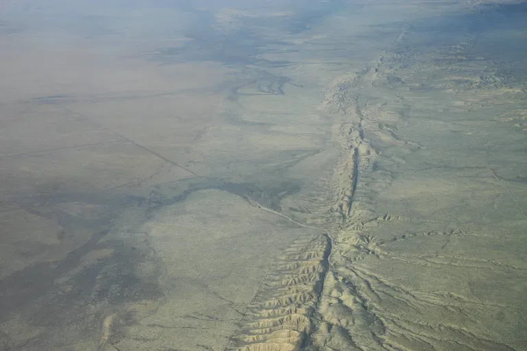
Los Angeles sits directly on top of some of the most active fault lines on Earth, which is why the phrase "earthquake los angeles" carries so much weight for the roughly 10 million people who call the region home. An earthquake is not a random disaster — it is the sudden release of energy that builds up when enormous slabs of rock, called tectonic plates, grind past one another deep underground. In June 2026, a study published in the Journal of Geophysical Research added fresh urgency to that science, reporting that the San Andreas and San Jacinto faults beneath Southern California are under their highest stress in 1,000 years. Understanding what causes these quakes, how scientists measure them, and why Los Angeles is uniquely vulnerable can help residents make sense of every shake and every alert.
What Causes an Earthquake? The Science of a Sudden Slip
An earthquake is caused by a sudden slip on a fault, the fracture where two blocks of rock meet, according to the U.S. Geological Survey (USGS). Tectonic plates are always moving slowly, but they get stuck at their edges because of friction. When the stress building along a fault finally overcomes that friction, the rock slips abruptly and releases stored energy as seismic waves that ripple through the ground and shake everything on the surface.
That idea is formalized in the elastic rebound theory, first proposed by geologist Henry Fielding Reid after the great 1906 San Francisco earthquake. Reid observed that rocks on either side of a fault bend and deform as stress accumulates over decades, like a stretched rubber band. Eventually the deformation exceeds the frictional resistance holding the fault locked, the two sides snap past each other into a new position, and the pent-up energy is released as an earthquake.
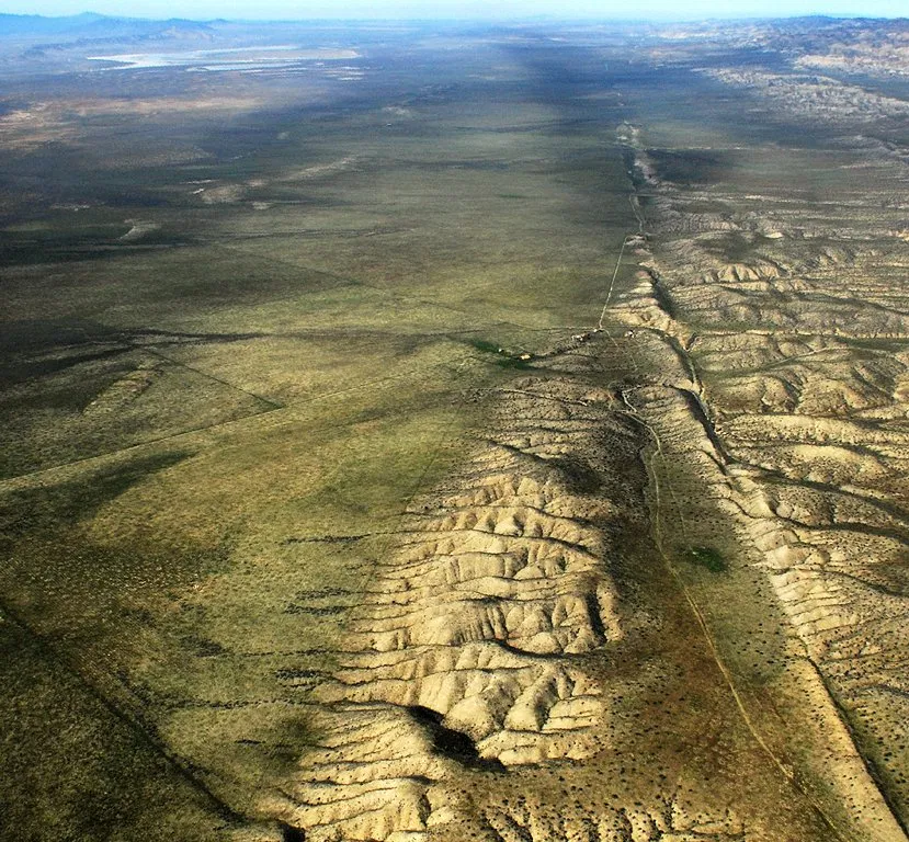
Most earthquakes occur at plate boundaries. California sits along the boundary where the Pacific plate slides northwest past the North American plate, a grinding collision that has created the state's sprawling web of faults. The point underground where the slip begins is called the focus, or hypocenter, while the epicenter is the spot directly above it on the surface.
Why Los Angeles Sits on Shaky Ground
Los Angeles is not built on a single fault but on a network of them. The city lies near the "Big Bend" of the San Andreas Fault, where the Pacific and North American plates change direction, and it is flanked to the east by the parallel San Jacinto Fault. The USGS describes Southern California as sitting astride the Pacific–North American plate boundary, a region riddled with northwest-trending strike-slip faults as well as hidden "blind thrust" faults that never break the surface.
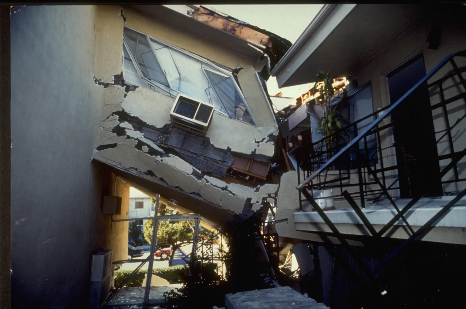
That last category proved devastating in 1994, when the magnitude 6.7 Northridge earthquake ruptured a thrust fault that geologists had not even mapped. The San Andreas is the headline fault, but the San Jacinto and dozens of smaller faults each carry their own risk, which is why shaking in the Los Angeles basin can strike from almost any direction.
How Scientists Measure an Earthquake's Strength
Earthquakes are described with two different numbers: magnitude and intensity. Magnitude measures the energy released at the source, while intensity describes the shaking and damage at a particular location.
The first widely used scale was the Richter scale, developed by Charles Richter in 1935, which measures the amplitude of seismic waves recorded on a seismograph. Because the scale is logarithmic, each whole number represents a tenfold increase in wave amplitude. But the Richter scale becomes unreliable for the very largest quakes, so scientists now prefer the moment magnitude scale (Mw), introduced in the 1970s by Hiroo Kanamori and Thomas Hanks. Moment magnitude estimates total energy released by accounting for the area of the fault that slipped and how far it moved.
On either scale the energy jump is enormous: each whole-number step corresponds to roughly 32 times more energy released. A magnitude 7 earthquake releases about 32 times the energy of a magnitude 6 and about 1,000 times that of a magnitude 5. To describe effects on the ground, scientists use the Modified Mercalli Intensity scale, which runs from I (not felt) to XII (total destruction).
Seismographs record several types of seismic waves. Primary waves, or P-waves, travel fastest and arrive first; secondary waves, or S-waves, follow; and slower surface waves cause most of the damaging shaking. That ordering is the foundation of California's early-warning system.
A Century of Shaking: The Faults That Shaped Los Angeles
- 1857 — Fort Tejon earthquake (M7.9): The last "great" rupture of the southern San Andreas, tearing a roughly 350-kilometer (217-mile) stretch from near Parkfield toward the Cajon Pass region.
- 1971 — San Fernando (Sylmar) earthquake (M6.6): Ruptured a thrust fault in the northern San Fernando Valley, killing dozens and prompting major building-code reforms.
- 1994 — Northridge earthquake (M6.7): Struck at 4:31 a.m. on January 17, killing about 57 to 60 people, injuring more than 9,000, and causing an estimated $13 billion to $50 billion in damage — one of the costliest natural disasters in U.S. history.
The 2026 Warning: Record Stress and the "Earthquake Gate"
The reason "earthquake los angeles" is back in the headlines is a June 2026 study published in the Journal of Geophysical Research. Researchers built new four-dimensional earthquake-cycle simulations using a 1,000-year paleoseismic rupture history of the San Andreas Fault and found that the southern San Andreas and parts of the adjacent San Jacinto Fault are under their highest stress levels in a millennium.
The study's most consequential finding centers on the Cajon Pass, a mountain gap where the San Andreas and San Jacinto faults come closest together. Scientists describe this junction as an "earthquake gate" that has historically stopped a rupture on one fault from jumping to the other. If that gate were to fail, a single earthquake could rupture both faults together — a joint rupture that would direct far more energy toward the heavily populated Los Angeles and Inland Empire basins.
More than 165 years have passed since the great 1857 Fort Tejon earthquake last released the southern San Andreas, and stress has been accumulating ever since. The USGS and its partners estimate roughly a 60% probability of a magnitude 6.7 or larger earthquake in the greater Los Angeles region over the next 30 years.
How Los Angeles Prepares: Early Warnings and What Comes Next
Because earthquakes cannot be predicted, California has focused on early warning. The ShakeAlert system, managed by the USGS in partnership with Caltech and other institutions, detects the fast-moving P-waves that arrive before damaging S-waves. When sensors detect a significant quake, the system can push alerts to phones and automated systems seconds before shaking hits — enough time to drop, cover, and hold on, slow a train, or pause a surgery.
Scientists caution that record stress does not mean an earthquake is imminent or predictable; it means the fault system is further along in its earthquake cycle. Experts recommend that residents secure heavy furniture, store water and supplies, and know their local hazards. As researchers continue to refine models of the Cajon Pass gate, the broader message stays the same: the next major Los Angeles earthquake is a question of when, not if.
The Bottom Line: What to Remember
- Earthquakes are caused by a sudden slip on a fault that releases stress built up between moving tectonic plates.
- Los Angeles is uniquely vulnerable because it sits on the San Andreas and San Jacinto faults, plus hidden thrust faults.
- Magnitude measures energy at the source, with each whole number equal to about 32 times more energy; the moment magnitude scale has largely replaced the Richter scale.
- The last great rupture of the southern San Andreas was the 1857 Fort Tejon earthquake (M7.9).
- A June 2026 study found record 1,000-year-high stress and a weakening "earthquake gate" at Cajon Pass, with roughly a 60% chance of a M6.7+ quake in the next 30 years.